Drone photography to measure volume
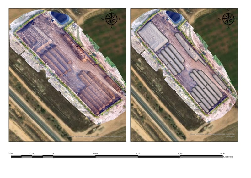
When we have a pile/pit in the field and we want to measure the volume it is a complex thing, a surveyor who comes gives an estimate which in most cases deviates from the reality by 20-30 percent. Such an exception can lead to heavy and unrealistic clearing/filling payments. We can use drone photography to do this in a computerized, fast and accurate way.